Lifestyle
Canberra's Light Rail and Urban Forest Transform Global Capital Transit
From light rail connectivity to urban forest integration, Canberra offers a transit experience unlike any other global capital.
3 min read
Updated 4 d ago
Lifestyle
From light rail connectivity to urban forest integration, Canberra offers a transit experience unlike any other global capital.
3 min read
Updated 4 d ago
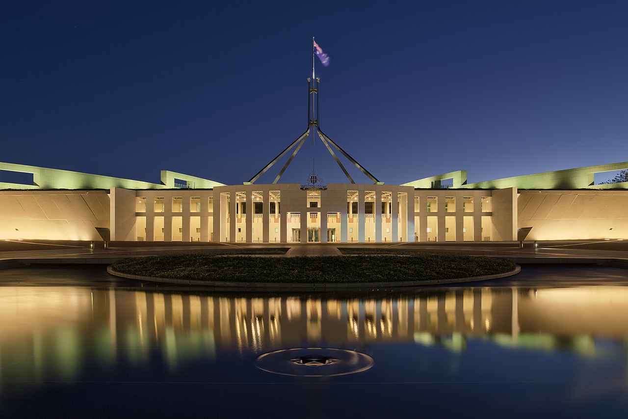
Canberra’s approach to urban transit remains defined by its intentional design, separating it from the dense, inherited grids of older international capitals. While cities like London or New York struggle with the legacy of industrial-era sprawl, the ACT government’s focus on the integrated light rail corridor continues to reshape how residents navigate the Parliamentary Triangle and beyond. The city’s geography, defined by open space and proximity to native bushland, dictates a flow of movement that prioritizes efficiency without sacrificing the landscape.
The city's transport strategy relies heavily on the Canberra Metro network, which acts as the spine for public movement between Gungahlin and the city center. Moving away from the traffic-heavy bottlenecks common in other major cities, the light rail project serves as a model for modern suburban integration. Pedestrians traversing Commonwealth Avenue or those heading toward the National Gallery of Australia benefit from a design philosophy that insists on accessibility to public institutions while maintaining the aesthetic integrity of the Walter Burley Griffin plan.
For those living in neighborhoods like Braddon or Dickson, the ease of connectivity to the CBD is a primary factor in daily life. The integration of bike-friendly paths throughout the inner north allows commuters to bypass traditional vehicle routes entirely. This is a marked shift from the experiences seen in more congested global hubs, where active transport often feels like an afterthought rather than a core component of the planning process.
Recent data indicates shifting patterns in how the capital utilizes its transport infrastructure. Transport Canberra records show continued patronage of the light rail system, which has become a fixture for residents accessing the main corridors. While market indicators across the country-such as national auction clearance rates-remain under pressure, the investment into transport hubs continues to drive activity in the surrounding real estate near Northbourne Avenue. Public records from the ACT government confirm the ongoing commitment to expanding these transit links to Woden, reflecting a long-term goal of decentralizing the workforce.
For residents and visitors, the best way to understand the city is to utilize the MyWay card system, which remains the standard for all public bus and light rail travel. Travelers should monitor the Transport Canberra website for real-time service updates, especially during peak commute hours. As the light rail extension projects progress toward the south, the city expects to further reduce dependence on private vehicle travel, maintaining its status as a unique example of planned urban mobility.

Lifestyle

Lifestyle

Lifestyle
Lifestyle
Lifestyle
Lifestyle
About this article
Published by The Daily Canberra
Spread the word
Daily brief
Free, in your inbox before 7am. Weekdays.
The Daily Network — local news across Australia